Here are the top 15 most popular satellite softwares as derived from our TpSort Score which is a continually popular score, it denotes an estimated popularity of a software.
 EarthBrowser is an innovative earth simulation that combines an easy to navigate 3 dimensional globe with real-time weather conditions and 7 day forecasts for thousands of locations worldwide. Live earthquakes, hurricanes, webcams, volcanoes and cloud animations are just some of data that is available in an instant. A great aid......
 myPlayer Pro - an Android app that provides access to a wide range of live TV and radio streams (without the requirement of flash). Catchup with all your favourite shows (within the UK) or add your own international feeds. Available now via the Google Play store.......
 SatHunter - an easy-to-use tool that will help you to align a satellite system and easily find the signal from a satellite. Find TV satellites in the sky.Features- Calculates the azimuth and elevation angle.- Provides a list of satellite transponders for setting up the receiver.- Calculates the solar azimuth angle.-......
 An extremly fast and easy Satfinder for Windows platform that will help you to setup a satellite system and easily find the signal from a satellite.......
 Gpredict is a real-time satellite tracking and orbit prediction application. It can track an unlimited number of satellites and display their position and other data in lists, tables, maps, and polar plots (radar view). Gpredict can also predict the time of future passes for a satellite, and provide you......
 UrtheCast is developing the world's first near realtime HD Earth video stream, via two cameras mounted aboard the International Space Station (ISS).UrtheCast is providing the world's first Ultra HD Earth video platform, streamed from space in near realtime. Using UrtheCast's powerful web platform, people from across the globe will soon......
 pTolemy3D projects goal is to provide FOSS tools necessary to build your own 3D GeoWeb application. The Viewer application is similar in concept to Google Earth and World WInd Java. Unlike WWJ, there is greater emphasis on the Browser as a platform.......
 MapSphere is a manageable way to view and organize geographical data of different kind. This might be raster maps and satellite imagery from various sources, your own information received from GPS, tracks of your friends, whatever you want.......
 GlobeInfos is a mobile tracking service : it offers geolocation of vessels, boats, cars, trucks through INMARSAT or IRIDIUM satellite networks and allow the possibility to visualize them online on your favorite web browser.Because of this unique feature, you can be tracked anywhere on earth in a real-time basis.Moreover, when......
 StarMap 3D Plus is the portable star atlas for beginners or advanced astronomers. Use StarMap 3D Plus to find the planets, stars, constellations, star clusters, galaxies, and nebulae visible to you based on your location and time. StarMap 3D will even use the compass to automatically align the map!......
 Google Earth lets you fly anywhere on Earth to view satellite imagery, maps, terrain, 3D buildings, from galaxies in outer space to the canyons of the ocean. You can explore rich geographical content, save your toured places, and share with others. Available also on Android and iPhone: see http://www.google.com/intl/en/mobile/earth/......
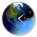 TerraTime provides an amazing, interactive, real-time virtual Earth. Its globes and maps use current satellite imagery to simulate day/night, clouds, seasons, sun & moon; clock shows rise, set, twilight, & transit times for sun & moon. TerraTime features:· Real-time simulations include clouds, city lights, sea ice, and more, generated from......
 Helps to measure distances or squares using a satellite map via your iPhone or iPad. You draw lines or polygons on the map - and get the corresponding values. App supports 58 unique measurement units in over then 10 measurement systems, western and oriental, traditional and region specific.......
 Marble is a Virtual Globe and World Atlas that you can use to learn more about Earth: You can pan and zoom around and you can look up places and roads. A mouse click on a place label will provide the respective Wikipedia article.......
 TV-Browser gets the daily TV program from the internet and shows it clearly aranged - like a printed TV guide. An internet connection is only necessary during the data update. It provides more than 500 channels (from Germany, USA, GB, Scandinavia & more), is platform independent and highly customizable. Note:......
| About | Terms |
| About UsContact Us | TpSort ScorePrivacy PoliceDMCA Policy |
© 2015-2016 www.tpsort.com, Inc